
English| EUR
Suggested for you
More currencies
Choose a language
The Tamarind Falls trail system spans three distinct difficulty tiers, from gentle riverside paths to technical scrambles over basalt ledges. Your experience depends entirely on how far you push into the canyon. This guide breaks down the terrain, navigation demands, and physical requirements for each waterfall tier so you know what you're signing up for.
Quick answer
Tamarind Falls hike difficulty ranges from easy to strenuous depending on how many cascades you visit. The first three waterfalls require moderate fitness with gentle slopes and clear paths, while reaching the upper four involves steep inclines, river crossings, and rope-assisted rock scrambles over wet basalt. Most visitors complete the lower circuit in two hours with basic fitness, but the full seven-cascade route demands strong legs, sure footing, and comfort with uneven, slippery terrain.
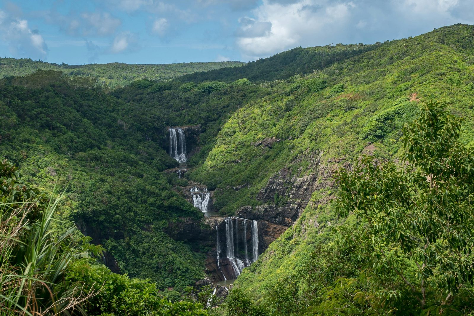
The trail starts deceptively easy. A dirt road from Henrietta Branch Road descends through sugarcane fields, wide enough for two people to walk side by side, the gradient gentle enough that conversation flows without breath breaking. Within twenty minutes you reach the first cascade, a modest veil tumbling into a jade pool, accessible to anyone who can manage a rural footpath. The second and third falls follow the same pattern: well-trodden routes, occasional stone steps, handholds carved by years of foot traffic. This lower circuit represents the moderate end of the tamarind falls hike difficulty spectrum, suitable for families and first-time hikers who arrive early and move at a steady pace. Beyond the third cascade, the trail fragments. What was a clear path becomes a choose-your-own-route scramble through riverbed boulders, exposed tree roots, and sections where fixed ropes dangle from rock faces slick with spray. The upper four waterfalls demand a different skill set: balance on uneven surfaces, confidence crossing knee-deep water over algae-coated stones, and the grip strength to haul yourself up short vertical pitches. The terrain shifts from compacted earth to sharp volcanic basalt, and the canopy thins, exposing you to midday sun. Fitness requirements escalate here—not because of distance, but because every meter forward requires active problem-solving and sustained muscle engagement. The trail lacks formal markings past the lower circuit. No signs, no painted blazes, just the memory of footsteps and the occasional cairn. Visitors routinely misjudge the challenge: they reach the third fall in under an hour, feel strong, and push onward without checking the time or their water supply. The return climb punishes that optimism. What felt manageable on the descent becomes a quad-burning slog when reversed, and the open sections that seemed trivial in morning light turn treacherous as afternoon clouds roll in and wet the rocks. The full route is not technically difficult by mountaineering standards, but it combines enough variables—heat, humidity, variable footing, navigation ambiguity—that casual underpreparation turns a scenic hike into an exhausting ordeal. The key variable is not the trail itself but the honesty with which you assess your own limits before the third cascade.
“What felt manageable on the descent becomes a quad-burning slog when reversed, and the open sections that seemed trivial in morning light turn treacherous as afternoon clouds roll in.”
The dry season from May to November provides the most stable conditions for hiking Tamarind Falls. Arriving during the best arrival window of 08:00–11:00 ensures you avoid afternoon heat and potential heavy rainfall.
Cooler with lower humidity, 20°C–25°C
Trails are dry and provide better footing for steeper sections. Stable conditions reduce the risk of slips on clay-heavy paths.
Humid and rainy, 25°C–30°C
Paths become extremely muddy, slick, and physically demanding. Increased water levels can make certain river crossings hazardous.
—
Starting between 08:00 and 11:00 helps you avoid the heat and ensures a return before dark. You face fewer trail encounters than on weekends.
Verdict: The best window for the hike is between May and November, arriving promptly between 08:00 and 11:00 on a weekday.
Tamarind Falls is a natural canyon environment that is not equipped for accessibility. The terrain features steep, uneven paths and physical obstacles that prevent use by individuals with limited mobility.
The natural trail terrain is unsuitable for wheelchairs.
The hike involves steep descents, ascents, and rocky passages.
No vertical transport options exist on this natural trail.
There are no public facilities available at the trailhead or along the route.
The trail lacks signage or aids for those with sensory impairments.
Visitor volume is lowest during the early hours of the recommended 08:00–11:00 arrival window.
The unmarked trail network and exposed basalt surfaces create genuine hazards that many visitors underestimate. These mistakes turn a moderate hike into a dangerous situation.
Hiking within 24 hours of heavy rain
Wet basalt becomes glass-smooth and has caused serious falls at every tier. Check recent weather and postpone if the trail received significant rain the previous day.
Navigating without offline GPS or a downloaded trail map
Cell service is patchy once you leave the trailhead, and the unmarked forest paths branch unpredictably. Download a GPS track or offline map before you arrive—several hikers each month require search assistance after taking wrong forks.
Wearing trail runners or sneakers instead of deep-lug boots
The volcanic rock and steep descents between pools demand ankle support and aggressive tread. Footwear with shallow grip has led to twisted ankles and slides on wet surfaces.
Starting the hike after 11:00 without accounting for return time
The full trail to the seventh cascade takes 4–5 hours round-trip, and afternoon rain can arrive suddenly. Arrive during the 08:00–11:00 window to ensure you're off the trail before conditions deteriorate.
Attempting to swim at the upper cascades during high flow
Strong currents form after rain and have pulled swimmers toward the fall edge. Only enter pools when water is clear and flow is visibly low—locals avoid swimming entirely during the wet season.
Pack strategically to counter the trail's slippery rocks, steep descents, and tropical heat.
Navigating Tamarind Falls requires preparation and local knowledge to manage the terrain effectively.
Connect with guides at the Henrietta Branch Road trailhead to locate unmarked paths that bypass the most strenuous vertical climbs.
Use exposed, sturdy tree roots as reliable handholds and foot placements during steep descents to maintain stability on loose soil.
Adhere to the 08:00–11:00 arrival window to minimize exposure to intense afternoon heat and reduce the risk of hiking during unpredictable late-day rain.
Walk with a slight forward lean and engage your core when navigating downhill sections to counteract the slippery nature of the basalt rock.
Observe where locals place their feet on steep gradients, as these established spots are often the most secure points for traction.
Expect the path to transition from dry forest floors to muddy stream crossings, so adjust your walking speed before reaching saturated zones.
Everything you need to know about tamarind falls hike difficulty
The tamarind falls hike difficulty is generally considered moderate to challenging due to steep descents and slippery terrain. Hikers should be prepared for uneven ground and potential mud along the canyon route. It is important to assess your personal fitness levels before attempting the full descent. Because of the rugged nature of the environment, many visitors choose to explore the area with local guides to navigate the trail safely. While it is an outdoor adventure, the terrain is often too demanding for young children or those without prior hiking experience. Navigating the steep embankments and crossing natural water features requires significant physical coordination. Visitors should prioritize stability and wear appropriate footwear to manage the intensity of the track. The trail features steep inclines and rocky segments that define the tamarind falls hike difficulty for many participants. These sections require careful foot placement and can be strenuous for those not accustomed to frequent elevation changes. Taking your time on these parts of the descent helps ensure a safer experience. Slippery basalt rocks and muddy patches can heighten the technical requirements of the route during wet conditions. While the landscape is inviting, moisture significantly increases the physical demand on the body. We advise checking local weather patterns to avoid challenging mud. Per our guidelines, the best arrival window is 08:00–11:00 to avoid afternoon heat and ensure a safe return before dark.
Tamarind Falls Hiking Trail Start Point
Read more Tickets & toursBook a Tamarind Falls Guided Tour
Read more GuideTamarind Falls Entrance Fees & Costs
Read more GuideHow to Get to Tamarind Falls
Read more GuideWhat to Wear to a Waterfall Hike
Read more GuideCan You Hike Tamarind Falls Without a Guide?
Read more GuideTamarind Falls Hiking Trail Map & Route
Read more