
English| EUR
Suggested for you
More currencies
Choose a language
Tamarind Falls is one of Mauritius's few major natural sites where independent hiking is both legal and practical. The trail network to the seven cascades is unmarked but well-worn, and thousands of visitors each year complete the route without a commercial guide. This page maps the decision points, the river crossings that matter, and the safety margin you need.
Quick answer
Tamarind Falls hike without guide is permitted and commonly done by confident hikers. The trail to the lower three cascades follows a clear dirt path from the trailhead in Henrietta, while the upper four cascades require scrambling over wet basalt and crossing shallow river sections. No permit or advance registration is required. Solo hikers should carry offline maps, wear grip-sole footwear, and avoid the trail during or immediately after rain when rocks become dangerously slippery.
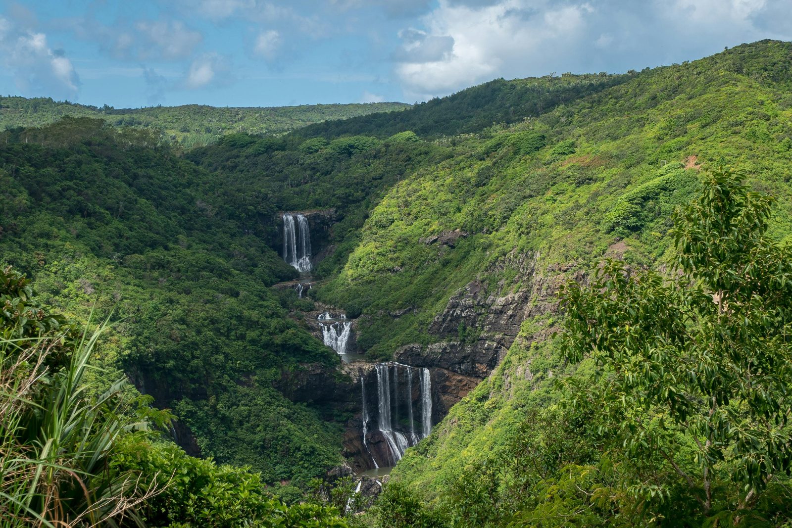
The seven-cascade system at Tamarind Falls spans roughly three kilometers of the Tamarin River gorge, descending from the central plateau toward the west coast. Unlike many heritage or conservation sites in Mauritius that require ticketed entry and supervised access, the falls sit on open land with no formal boundary or gate. The trailhead lies at the end of a residential road in Henrietta, marked only by parked cars and a gap in the vegetation where the path begins. Navigating the tamarind falls hike without guide means reading the landscape rather than following signage. The route to the first three cascades—known locally as the lower tier—is a wide dirt track carved by years of foot traffic. It curves along the ridgeline, offering occasional views into the gorge before descending via a series of natural stone steps. Most turnarounds happen here: the viewpoint above the third cascade is the psychological halfway mark, and the return climb takes twenty to thirty minutes. Continuing to the upper four cascades requires crossing the river at a rock ledge below the third fall, then scrambling upstream over boulders and exposed tree roots. This section is narrow, wet in all seasons, and requires both hands free. The risk profile changes with weather. Mauritius receives sudden afternoon rain from November through April, and the basalt bedrock becomes mirror-slick within minutes. Local search-and-rescue teams report that most falls-related incidents occur on the descent from the upper cascades after rain, where hikers lose footing on the same ledges they crossed safely an hour earlier. The trail is accessible year-round, but the margin for error is wider in the dry months of May through October when the river runs lower and rock surfaces dry between morning and midday. Solo hikers should carry a fully charged phone with offline map data and share their planned return time with someone off-trail. The mobile signal is intermittent below the third cascade and absent near the upper falls. Water-resistant footwear with aggressive tread is not optional—smooth-sole sneakers are the single most common denominator in slip incidents. A small drybag for electronics and a basic first-aid kit add negligible weight and meaningful insurance. The round trip to all seven cascades takes three to five hours depending on pace and time spent at each pool, with the return climb representing the majority of cardiovascular effort.
“The risk profile changes with weather—basalt bedrock becomes mirror-slick within minutes of afternoon rain.”
Hiking Tamarind Falls independently requires basic navigation skills and attention to trail markers. The full route to all seven falls takes 3–4 hours round trip.
Leave your vehicle near the stone bridge where the road forks toward the sugarcane fields. Local residents sometimes offer informal parking for a small fee; confirm the rate before leaving your car.
Walk along the red laterite path that runs parallel to the riverbed. The trailhead is unmarked—look for worn earth and footprints heading into the vegetation approximately 200 meters past the bridge.
Wade through the shallow crossing using visible rocks as footholds. The stones become slick after rain; test each step and avoid moss-covered surfaces.
The waterfalls progress upstream in sequence. Keep the sound of rushing water on your left and follow the narrow footpaths that branch toward each cascade—locals have worn these side trails distinct from game tracks.
Use your phone to drop GPS pins or photograph distinctive trees at each fork. The return journey reverses your path, and without markers most hikers take wrong turns into dead-end sugarcane access roads.
If the footpath fades completely or requires scrambling over wet boulders taller than waist height, you've missed the maintained route. Retrace to the last clear junction rather than improvising a new line.
Tamarind Falls is located in Henrietta, Vacoas-Phoenix, and is most accessible by private vehicle or taxi. Public transport connects to nearby towns, requiring a final transfer to the trailhead.
Drive via B104 towards Henrietta; park near the entrance in designated areas.
Direct hire to the Henrietta entrance.
Bus to Vacoas or Curepipe, then transfer to a local bus toward Henrietta.
Arrive between 07:00 and 10:00 to secure parking near the start of the trail and avoid midday heat. Using a GPS navigation app to reach the Henrietta bus terminus or the start of the access road is the most reliable method for independent travelers.
Tamarind Falls is a public natural site, and access for individual hikers is free of charge. There are no official conservation fees or admission tickets required for independent navigation.
Verdict: A typical adult pays 0 MUR, as there are no official entrance fees or conservation charges for this hike.
Hiking Tamarind Falls independently requires proper gear and preparation to navigate unmarked trails safely.
Hiking Tamarind Falls without a guide is popular, but several avoidable errors turn a straightforward trek into a risky ordeal. Most issues stem from underestimating the terrain and ignoring local conditions.
Taking the wrong trail fork at the second cascade
The main path splits near the second waterfall; stay right and look for worn rock steps descending toward the pool. The left fork dead-ends on a slippery ledge.
Wearing smooth-soled shoes on wet basalt
Basalt boulders become glass-smooth when wet. Proper hiking boots or trail runners with aggressive tread prevent dangerous slips, especially after morning mist or brief showers.
Ignoring weather and hiking during afternoon rain
Afternoon thunderstorms between November and April make trails treacherous within minutes. Check the forecast and start early; if clouds build mid-hike, turn back immediately.
Underestimating descent time and leaving too late
The hike down takes 90–120 minutes from the upper falls, and the final stretch through forest becomes difficult in low light. Arrive by 08:00 to ensure a safe return before 15:00.
Not bringing enough water for the climb back
The return ascent is steep and exposed; dehydration hits hard in midday heat. Carry at least 2 litres per person and drink consistently, not just when thirsty.
Attempting to swim at unmarked pools without checking depth
Several pools have submerged rocks and uneven bottoms. Only swim at the well-used lower basin where the depth is visible and locals confirm it's safe.
Tamarind Falls is accessible throughout the week, though hikers should strictly plan their trek during daylight hours for safety.
Everything you need to know about tamarind falls hike without guide
While the area is accessible, the terrain can be challenging due to steep sections and shifting weather, making a tamarind falls hike without guide risky for those unfamiliar with local topography. Navigation often proves difficult, and trail conditions can change rapidly after rainfall. Many visitors prefer local expertise to ensure they reach the cascades safely.
Preparation is essential for any independent explorer. You should study the trail map, check local weather reports, and ensure you have proper footwear to manage the slippery volcanic soil and river crossings found throughout this Mauritius landmark. Navigating the Seven Cascades valley requires attention to detail.
There is 0 MUR entrance fee for the Tamarind Falls hike without guide as it is a public nature area. No official conservation fee is required for independent access to the trails. This allows hikers to enjoy the scenic vistas and water features at no cost.
The site is located in Henrietta, Vacoas-Phoenix. Most visitors arriving by car or bus navigate to the Henrietta bus terminal before proceeding toward the trailhead, which serves as the primary gateway for those exploring the canyon independently. Plan your route carefully to ensure a smooth start to your day.
The path consists of informal trails that often lack clear signage, which is a major factor when considering a tamarind falls hike without guide. Hikers frequently encounter forks in the path and dense vegetation, requiring strong navigational skills to stay on the correct route. GPS tracking or offline maps are highly recommended for your journey.
Families may find the terrain demanding, especially the steep descents toward the lower pools. While the scenery is pleasant, those planning a visit without a professional should assess their group's fitness level carefully before attempting the trek. Staying on well-trodden paths is necessary to maintain safety throughout the excursion.
Tamarind Falls Hiking Trail Start Point
Read more GuideTamarind Falls Hike Difficulty & Safety
Read more Tickets & toursBook a Tamarind Falls Guided Tour
Read more GuideTamarind Falls Entrance Fees & Costs
Read more GuideHow to Get to Tamarind Falls
Read more GuideWhat to Wear to a Waterfall Hike
Read more GuideTamarind Falls Hiking Trail Map & Route
Read more