
English| EUR
Suggested for you
More currencies
Choose a language
Tamarind Falls sits inland from the west coast, reached via routes that converge on Henrietta Branch Road near Vacoas-Phoenix. The cascade system lies beyond the sealed road network, accessed by a rough track and then on foot. This guide maps the approach by car, taxi and local transport.
Quick answer
Tamarind Falls is located on Henrietta Branch Road in Vacoas-Phoenix, Mauritius. Most visitors drive or hire a taxi to the trailhead parking area, which lies approximately 1.5 kilometres inland from the paved road. The site is open daily from 00:00 to 23:59 with free entry. Arriving between 08:00 and 12:00 avoids midday heat and afternoon rain, ensuring safer trail conditions for the descent to the cascades.
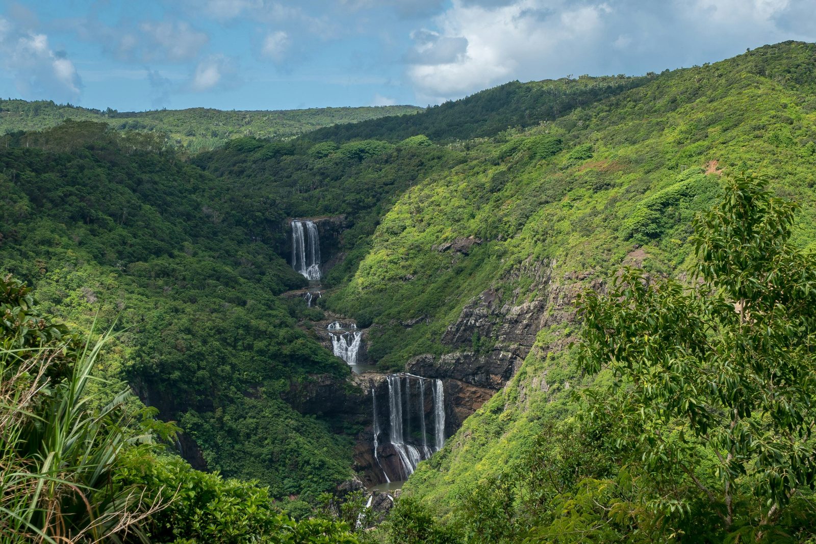
The seven-tier waterfall system known as Tamarind Falls—also called Tamarin Falls or Les Sept Cascades—occupies a forested river gorge in the central plateau district, roughly equidistant from the tourist centres of Flic en Flac and Quatre Bornes. Its seclusion is both the draw and the navigation challenge: no large signs mark the final approach, and the access track is unpaved, rutted in places, and impassable after heavy rain. Reaching how to get to tamarind falls begins with the main arterial roads. From the coastal highway near Tamarin Bay, take the A3 inland toward Plaine Wilhems, then turn onto Henrietta Branch Road. The turnoff is unmarked but identifiable by a cluster of roadside guides offering tours. From Port Louis, the route runs south via the M2 motorway to Quatre Bornes, then west along local roads that intersect Henrietta Branch Road. GPS coordinates for the trailhead parking area are widely shared among visitors, and mobile signal strength remains adequate for navigation until the final kilometre. The unpaved access track demands either a high-clearance vehicle or a willingness to walk the last stretch. Local taxi drivers familiar with the site will negotiate the track in dry conditions; others prefer to drop passengers at the sealed-road junction. Parking is informal—a cleared area where the track widens—with no attendant or marked bays. Mornings see fewer vehicles and easier manoeuvring. The trailhead itself is a break in the vegetation where a narrow footpath descends toward the sound of water. Public transport does not serve the immediate area. Visitors relying on buses can reach Vacoas-Phoenix or Quatre Bornes, then arrange a taxi for the final leg. The route to the cascades involves steep, uneven terrain; appropriate footwear and daylight are non-negotiable. Most visitors allow three hours for the return hike, though trail familiarity and fitness levels vary. The site imposes no entry fee, operates without gates or staffing, and remains accessible around the clock—though arriving outside the recommended morning window increases exposure to weather and trail hazards.
“The access track demands either a high-clearance vehicle or a willingness to walk the last stretch.”
Everything you need to know about how to get to tamarind falls
You can reach the site by driving to Henrietta Branch Road in Vacoas-Phoenix, where parking is available near the trailheads. Following local signage or using GPS navigation is the most reliable method for how to get to tamarind falls.
There is no entrance fee for visitors, as the area is open to the public for free. This makes the attraction an accessible destination for those researching how to get to tamarind falls on a budget.
The best arrival window is between 08:00 and 12:00 to avoid the intense midday heat and the common afternoon rains. Starting your journey early ensures a safer hiking experience when you figure out how to get to tamarind falls.
Public transport options to the Henrietta area are limited, so most visitors prefer renting a car or arranging a private transfer. While you may find bus routes toward Vacoas, walking the final distance requires careful planning when considering how to get to tamarind falls.
Yes, local guides offer professional excursions that help you navigate the valley safely and identify key scenic viewpoints. Booking a guided trek is a popular way to explore these Mauritius waterfalls without the stress of navigating unmarked paths.
Pack sturdy hiking boots, water, sun protection, and a light rain jacket to prepare for the island's variable weather. Navigating the rugged topography of this canyon requires proper gear regardless of how to get to tamarind falls.
Tamarind Falls Hiking Trail Start Point
Read more GuideTamarind Falls Hike Difficulty & Safety
Read more Tickets & toursBook a Tamarind Falls Guided Tour
Read more GuideTamarind Falls Entrance Fees & Costs
Read more GuideWhat to Wear to a Waterfall Hike
Read more GuideCan You Hike Tamarind Falls Without a Guide?
Read more GuideTamarind Falls Hiking Trail Map & Route
Read more