
English| EUR
Suggested for you
More currencies
Choose a language
The Tamarind Falls hiking trail start sits along Henrietta Branch Road in Vacoas-Phoenix, accessible year-round without an entrance fee. This guide pinpoints the trailhead, clarifies access routes, and explains what you'll encounter at the beginning of one of Mauritius's most rewarding waterfall hikes.
Quick answer
The Tamarind Falls hiking trail start is located on Henrietta Branch Road in Vacoas-Phoenix, Mauritius, with free entry available every day from midnight to midnight. The trailhead is reached via a short walk through private sugarcane fields, and most hikers arrive between 07:30 and 10:00 to complete the route in daylight and avoid midday heat.
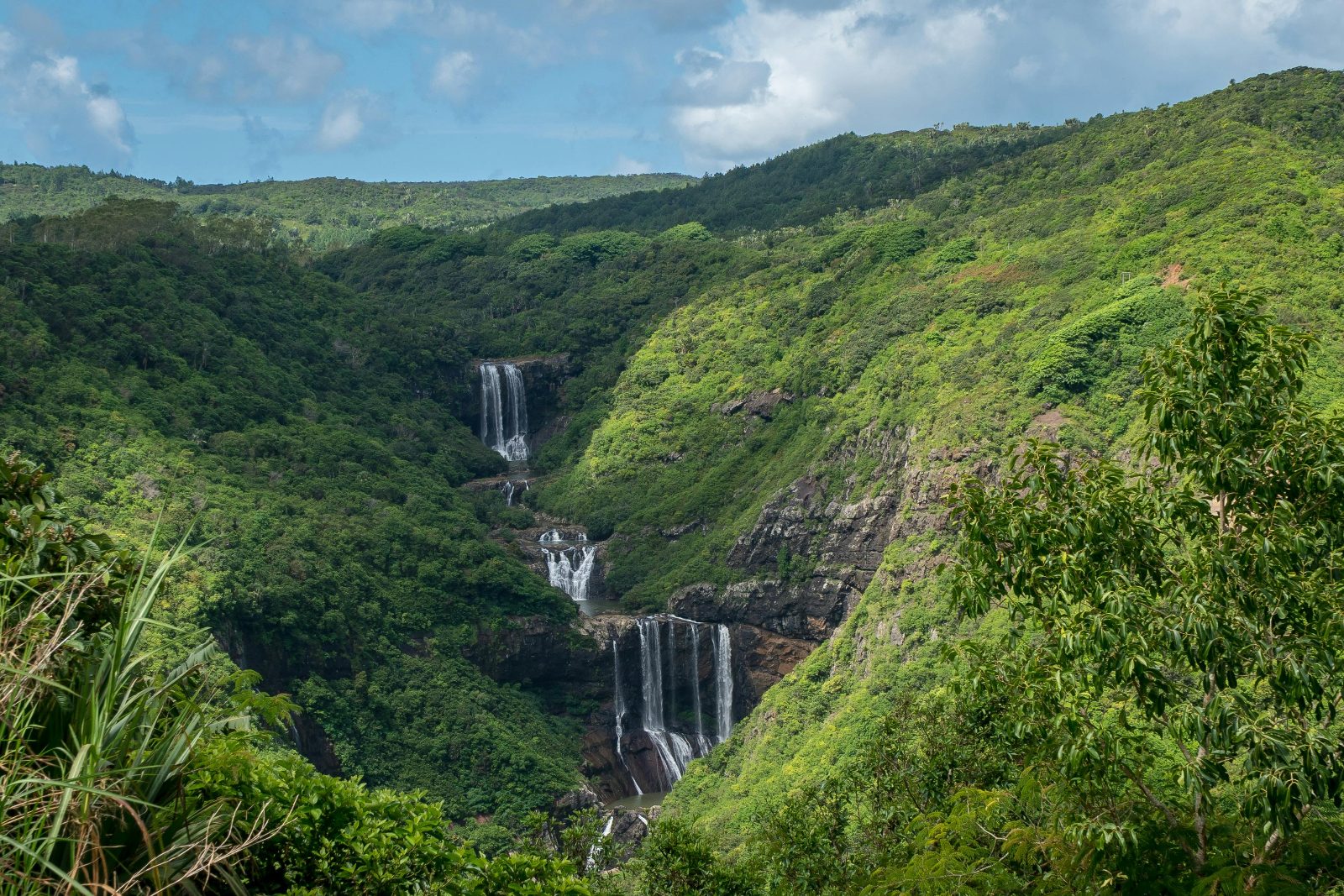
The Tamarind Falls trail begins not with a signposted gate or marked parking lot, but with a dusty turnoff along Henrietta Branch Road where the pavement gives way to red dirt and the first views of the gorge open through the cane. This lack of formal infrastructure is part of the hike's character. The trail passes through working agricultural land before descending into the canyon, and the transition from road to footpath is gradual rather than abrupt. Understanding the tamarind falls hiking trail start means recognizing that the route is semi-formal. There is no ticket booth, no visitor center, and no ranger station. The path is maintained by foot traffic rather than park authorities, and the entrance lies beyond a gap in the vegetation that can be easy to miss if you're expecting a clear trailhead marker. Most visitors park along the shoulder of Henrietta Branch Road and walk in, following worn ground through the cane rows until the trail proper begins at the edge of the gorge. The hike itself descends through seven distinct tiers of waterfalls, each requiring scrambles over basalt ledges and wading through shallow pools. The upper cascades are smaller and easier to reach, while the lower falls demand more technical footwork and stronger route-finding skills. The entire loop takes between three and five hours depending on how many basins you swim in and whether you reverse your path or exit via the alternative route through the forest. Timing matters. The best arrival window is 07:30 to 10:00, when the light is still angled and the rock faces haven't absorbed the full force of the tropical sun. Afternoon storms are common during the wet months from December through March, and the trail becomes slick and harder to navigate once the basalt is wet. The cascade flow is strongest after rain, but the rocks are also more treacherous. Dry season from May through November offers the most stable footing, though the pools are shallower and the falls less dramatic. The starting point for the Tamarind Falls hike is open every day with no fee, but the experience is shaped entirely by preparation and self-reliance. There are no facilities at the trailhead, no water sources beyond the river itself, and no rescue infrastructure if something goes wrong. The hike rewards those who arrive early, move carefully, and respect the terrain for what it is: a working river canyon that happens to allow passage.
“The trail begins not with a gate, but with a turnoff where pavement gives way to red dirt and the first views of the gorge open through the cane.”
The Tamarind Falls hiking trail start is located off Henrietta Branch Road in Vacoas-Phoenix. Access is most straightforward by private vehicle or local bus services heading toward the Henrietta area.
Bus to Henrietta Terminal, then walk to trailhead
Drive to Henrietta Branch Road near the cemetery
Taxi to Henrietta Branch Road
The trailhead is commonly accessed via the parking area near the local cemetery. We recommend arriving between 07:30–10:00 to ensure a full day of hiking in favorable conditions.
The route from the trailhead to the first waterfall takes 15–20 minutes and follows a well-worn path through sugarcane fields before descending into the forest. Most visitors complete this opening stretch without difficulty, though the field crossing can be disorienting without clear markers.
From the parking area on Henrietta Branch Road, follow the dirt path that cuts through the sugarcane plantation for approximately 400 meters. The path is narrow and locals sometimes use it, so stay on the main trail rather than branching into the crop rows.
At the edge of the field, you'll see a small clearing where the forest canopy begins—this is the official trail entrance. The transition is marked by a change in ground cover from dirt to exposed rock and roots.
The trail immediately drops in elevation once you enter the forest, with loose rocks and exposed tree roots forming natural steps. Use trees for balance during wet conditions, as the clay soil becomes slippery after rain.
Follow the sound of rushing water and continue downhill for another 10 minutes. The trail forks twice—stay on the wider left path at each split to reach the lowest tier with the swimming pool.
The best arrival window for Tamarind Falls is 07:30–10:00 to beat the midday heat and ensure the hike is completed during daylight hours. Planning your start within this timeframe allows for safer navigation and more comfortable temperatures throughout the trek.
Hot, humid, rain showers likely
The warmer months bring higher humidity and frequent, short-lived rainfall.
Cooler, drier, 18°C–25°C
This period offers drier conditions and lower temperatures, making it favorable for hiking.
—
Midweek arrivals offer quieter trails compared to the busier weekend period.
Verdict: Aim to arrive between 07:30–10:00, preferably during the cooler, drier months of May to October.
Most visitors arrive unprepared for navigation or fall prey to aggressive guide touts at the bus station. A few precautions will save you time and money.
Relying on mobile data for navigation once on the trail
Download offline maps (Maps.me or Organic Maps) before you leave your accommodation. Cell reception disappears beyond the sugarcane fields.
Hiring expensive guides at the bus station under pressure
The trail is well-trodden and requires no guide. Politely decline and walk confidently toward Henrietta Branch Road.
Wearing running shoes or sandals on wet basalt rocks
The basalt around each pool becomes treacherous when wet. Wear hiking boots or trail runners with deep tread.
Starting after 11:00 without accounting for the return hike
The hike takes 3–4 hours round trip, and you want to finish before dusk. Aim to arrive by 10:00 at the latest.
Leaving valuables visible in a parked car near the trailhead
Petty theft does occur in the roadside parking area. Lock everything in the trunk or take it with you.
Everything you need to know about tamarind falls hiking trail start
The trail entrance is situated at Henrietta Branch Road, Vacoas-Phoenix, Mauritius. You can navigate to this specific area to begin your trek toward the cascades.
There is no cost to access the area, as the entrance fee is 0 MUR. Visitors can enjoy the natural scenery and canyon views without purchasing a ticket.
You should plan your arrival for the best arrival window of 07:30–10:00. Arriving during these hours helps you avoid the intense midday heat and ensures you have enough daylight to complete the journey.
The site is open daily from 00:00–23:59. While the area is technically accessible at all times, hiking is strictly recommended during daylight hours for safety.
The trail includes steep sections and uneven terrain that may be challenging for young children or those without prior hiking experience. We recommend assessing your fitness level before attempting to navigate the path to the valley floor.
Many visitors underestimate the difficulty of the descent and the importance of proper footwear. Miscalculating the time needed can lead to being caught in the forest after sunset, so always plan your return trip well before dark.
Tamarind Falls Hike Difficulty & Safety
Read more Tickets & toursBook a Tamarind Falls Guided Tour
Read more GuideTamarind Falls Entrance Fees & Costs
Read more GuideHow to Get to Tamarind Falls
Read more GuideWhat to Wear to a Waterfall Hike
Read more GuideCan You Hike Tamarind Falls Without a Guide?
Read more GuideTamarind Falls Hiking Trail Map & Route
Read more